Aerial Photography for Litigation
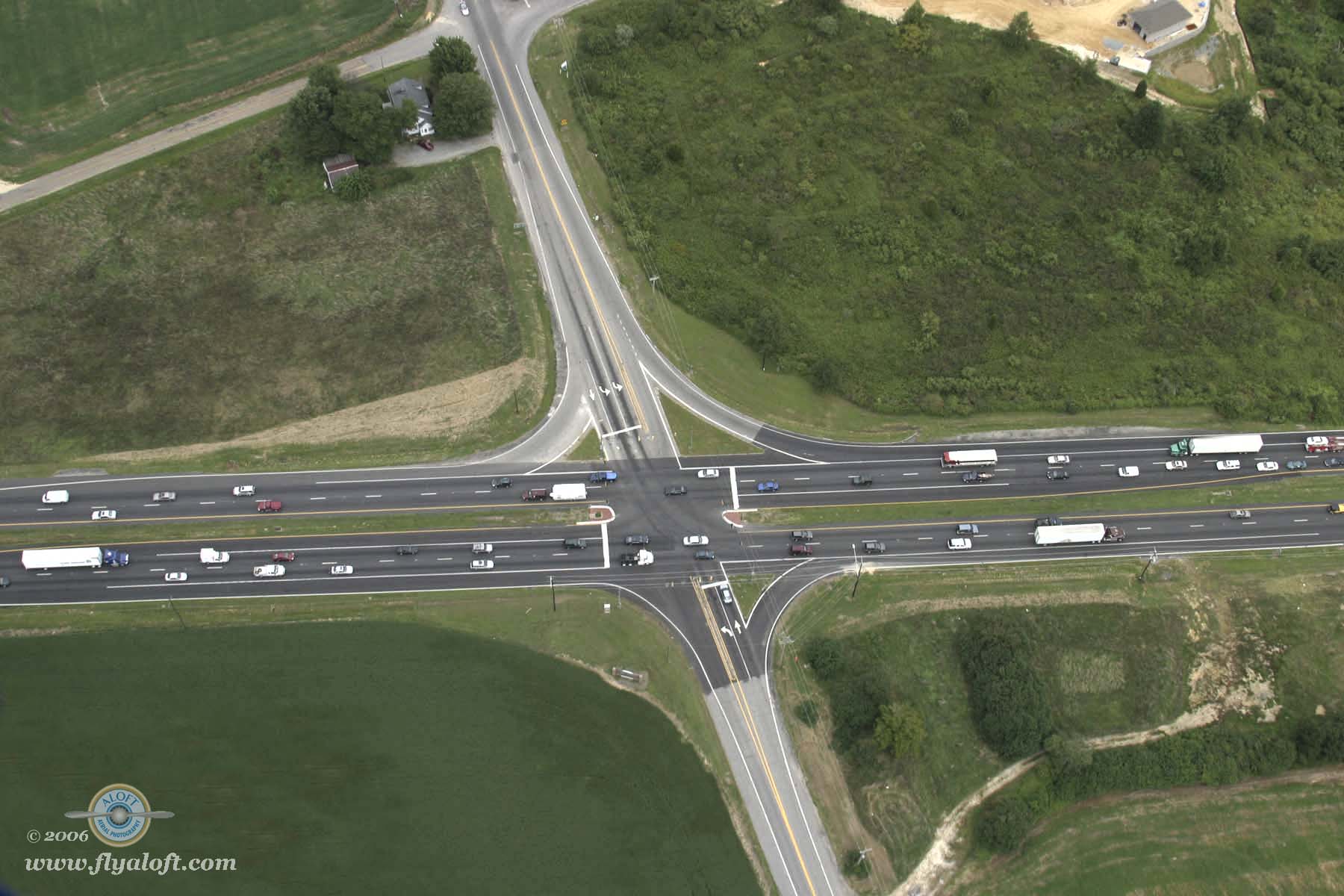
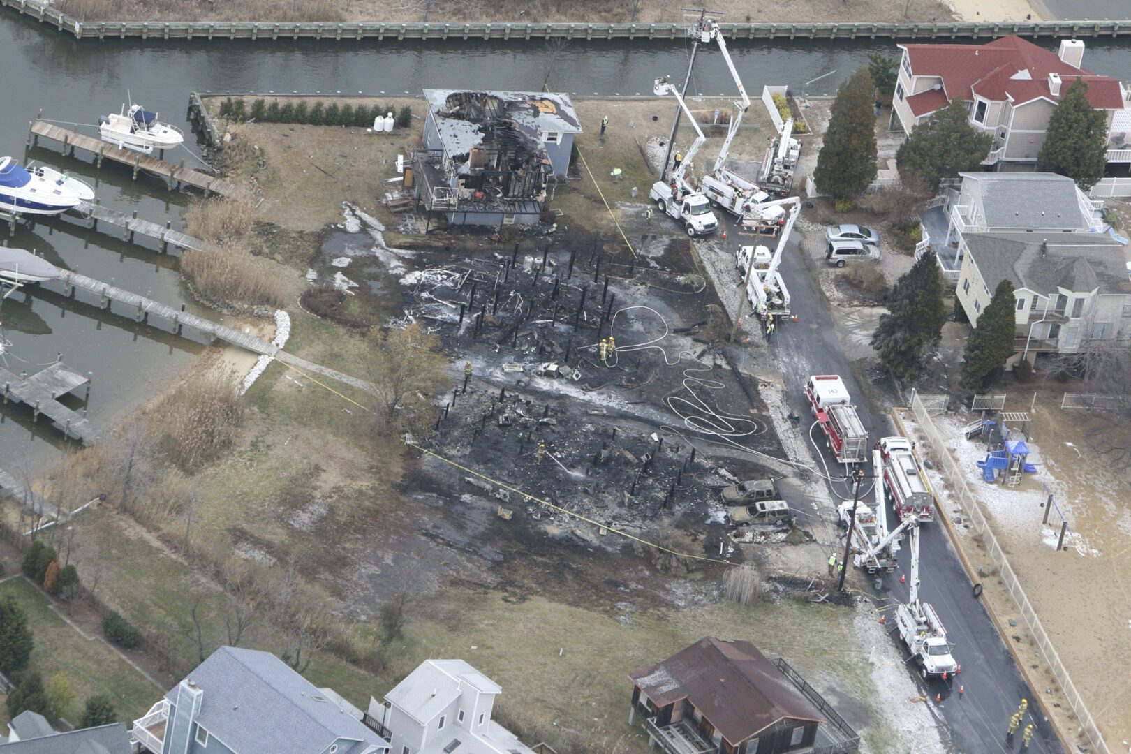
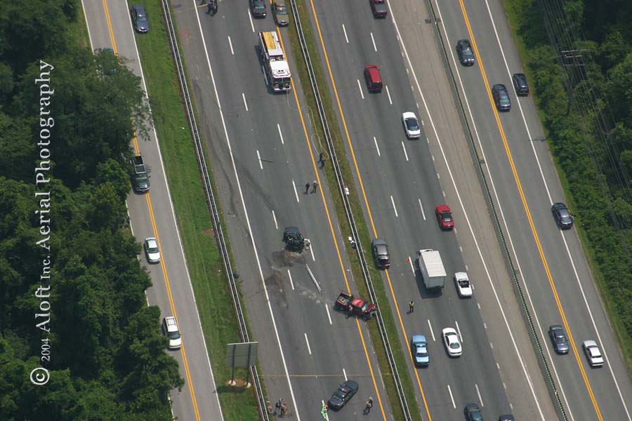
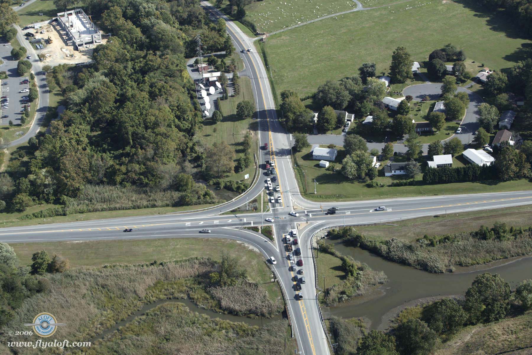
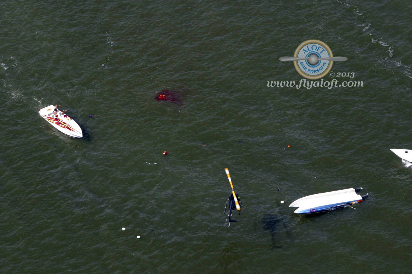
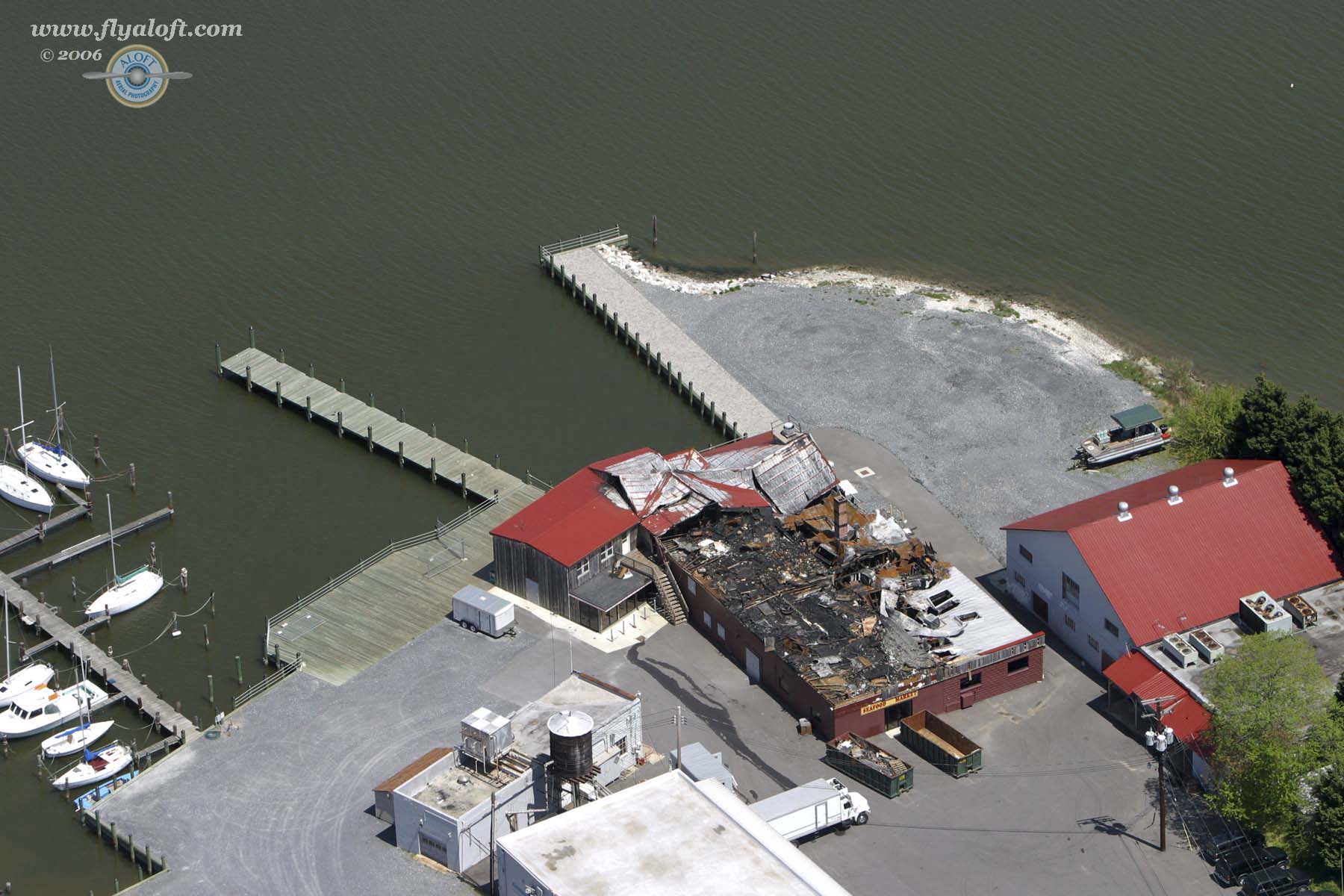
Attorneys, insurance companies and the police often require aerial views for the best documentation of accident scenes, crime scenes and property damage. Aerial photos help you win in the courtroom. They are also valuable tools for land boundary disputes, urban and rural planning and environmental impact studies. We can also provide services such as adding property lines, compass directions, route numbers and other indicators to photos. Please use the ‘site locator’ tool below to show us where your area of concern is located and contact Aloft to discuss your specific needs so we may support your case with stunning aerial images.
Here's what our clients are saying...
"Two years ago, I retained Aloft Aerial to prepare a 40” x 60” aerial photograph of an intersection here in Dorchester County for use as a trial exhibit. That photograph, along with other expert testimony, convinced the jury that my client was not at fault in the accident. Your professional service contributed to the successful result and I was very satisfied.."
~ Raymond H. Simmons Jr. ESQ
